| Publications | Persons | Institutes | Projects | ||
|
Kaart
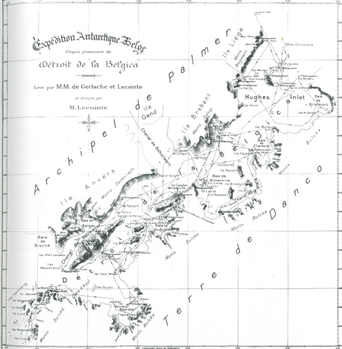
Description Een voorlopige kaart van het nieuw ontdekte gebied tijdens de Belgica-expeditie van 1897-1899 naar Antarctica, van de hand van Georges Lecointe. De Gerlachestraat wordt hier nog aangeduid als de Straat van de Belgica.
JPG file - 721.05 kB - 1 242 x 1 268 pixels
added on 2015-09-02221 viewsFrom reference Lambrechts, J. (2011). Antarctica: De Belgen op de Pool. ...From reference VLIZ Wetenschatten (2015). Het poolschip Belgica - Histor...
This work is licensed under a Creative Commons Attribution-NonCommercial-ShareAlike 4.0 International License
Click here to return to the thumbnails overview |

