| Publications | Persons | Institutes | Projects | ||

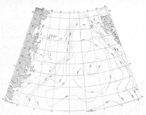
Description Een bathymetrische kaart van de Groenlandzee, waarbij alles puntjes de nieuwe peilingen aanduiden die uitgevoerd werden aan boord van de Belgica in 1905 en 1909.
JPG file - 2.22 MB - 2 945 x 2 334 pixels
added on 2015-09-02195 viewsFrom reference Pergameni, Ch. (1935). Adrien de Gerlache: Pionnier marit...From reference VLIZ Wetenschatten (2015). Het poolschip Belgica - Histor...
This work is licensed under a Creative Commons Attribution-NonCommercial-ShareAlike 4.0 International License
Click here to return to the thumbnails overview |