Welkom op het expertplatform!
Dit platform verschaft informatie en kennis omtrent de WL expertisedomeinen 'hydraulica en sediment', 'havens en waterwegen', 'waterbouwkundige constructies', 'waterbeheer' en 'kustbescherming' - gaande van WL medewerkers met hun expertise, het curriculum van deze instelling, tot publicaties, projecten, data (op termijn) en evenementen waarin het WL betrokken is.
Het WL onderschrijft het belang van "open access" voor de ontsluiting van haar onderzoeksresultaten. Lees er meer over in ons openaccessbeleid.
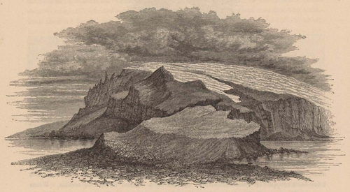
Renard (1888, pl. 13)
Beschrijving From a sketch by Mr. Buchanan, representing the mountainous promontory forming the north-western end of the island. The top of the mountain was enveloped in cloud, below which the greater part of its sides were covered by a glacier descending to the edge of the precipitous rock cliffs, over which the ice-masses fell thundering. The sketch was taken from the shoulder of a red conical hill, against which the ice, descending from the main mountain of the island to the sea, splits and passes on both sides of it.
Plaats: Heard Island
JPG bestand - 1.70 MB - 2 139 x 1 178 pixels
toegevoegd op 2012-07-16479 viewsUit bron Renard, A. (1888). Report on the rock specimens collected... (pagina 151)
Klik hier om terug te keren naar miniatuurweergave


